Introduction
During the initial 2020 Covid lockdown I decided that running would be a good way to be able to see slightly more of the world than the just inside of my tiny flat. Even before the pandemic I had a habit of running the same old routes all the time.
Inspired by Every Single Street with Rickey Gates, I came up with the idea to try to run all streets within the M60 ring road around Manchester.
 |
|---|
| Standard UK road sign for the M60 motorway/ring road |
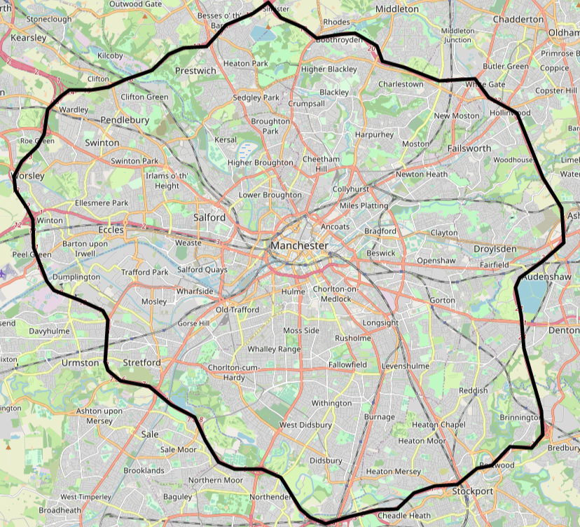
Why the M60? Good question. At the time I was living in central Manchester and the ring road seemed to provided the best ‘natural’ bounded area to focus on. While the Mancunian Way (major red road below Manchester text in the image below) does potentially form part of a smaller ring around the city centre, it would not cover enough roads for the challenge to be fun. Using borough boundaries was also a possibility, just one that I didn’t consider at the time!
 |
|---|
| The M60 in all its majesty. (OpenStreetMap) |
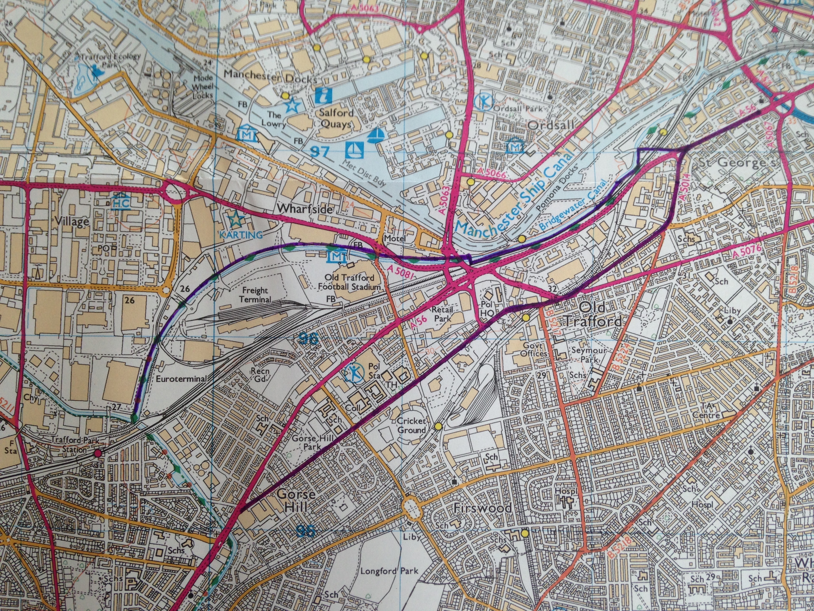
The next question was how to track progress. Initially I wanted to keep things very low-tech and bought an Ordnance Survey (OS) map (OS explorer 277) that I updated with progress.
 |
|---|
| Ordnance Survey map that I use to track progress. This photo is from the very birth of the project after only 2 runs (June 2020). One run goes along the Bridgewater Canal, the other past Old Trafford cricket ground. |
 |
|---|
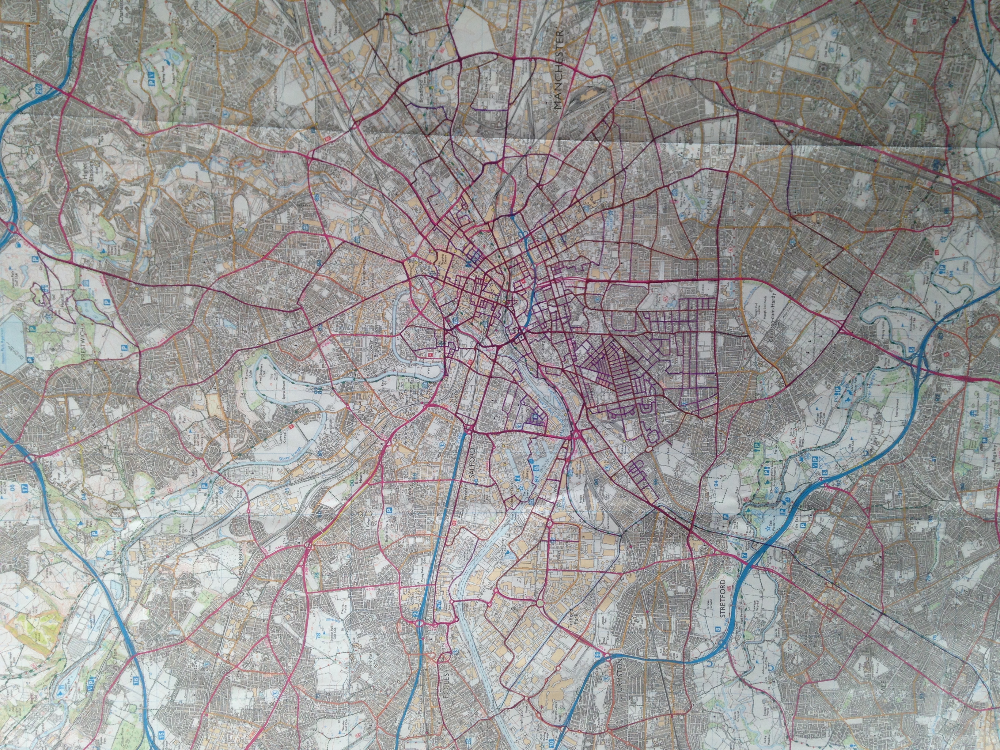
| Progress after a few months in September 2020. Most progress around the city centre and Old Trafford area, with some longer runs, including one outside the M60(!) along the Bridgewater Canal to Altrincham. |
As 2020 continued I began to think about more advanced ways to track progress. There are existing solutions for this e.g. #everystreet challenge and CityStrides. However, I had the time and inclination to make something myself. My job at the time involved using Open Street Map (OSM) a lot, so I decided to use that as the basis for the app that lives in this repo.
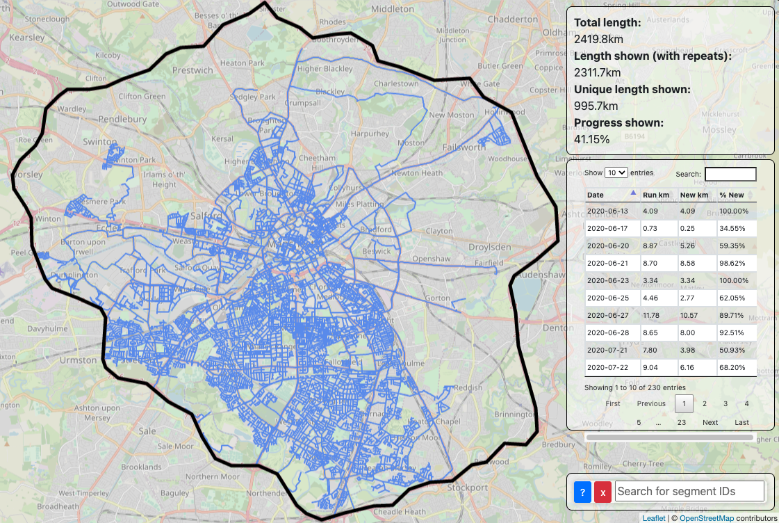
Over the course of the next nearly 3 years I’ve continued to make progress, tracking both through the OS map and the app. Since I do not drive and am thus reliant on public transport, it has become harder and harder to make progress once all nearby roads have been run. Nevertheless, I’m still plodding away, with the current status as of mid February 2023 shown below:
 |
|---|
| App that I made to track progress alongside the OS map. This display does not capture any portions of runs that are not on roads included in the challenge, e.g. in parks or footpaths. The OS map has the advantage that this information can be included. |
I decided that I would make this blog to share more about the project, new runs and anything else I think of. Some topics I aim to include in later posts are:
- Progress over time
- My favourite roads (so far)
- Optimising progress via tram stops
- Roads with interesting geometry
- Deciding which roads should be included in the challenge
- Updating OSM